お気に入りのオリジナル写真を加工して作る、高画質のアハ体験ムービー。フェーズ31は、2014年から2018年、広島の呉から今治までのとびしま海道と、今治から尾道までのからしまなみ海道を、自転車道で走った時の写真だ。
High quality AHA experience movies made by processing your favorite original photos. Phase 31 is a photo of the Tobishima Kaido from Kure to Imabari in Hiroshima and the Shimanami Kaido from Imabari to Onomichi on the bicycle path from 2014 to 2018.
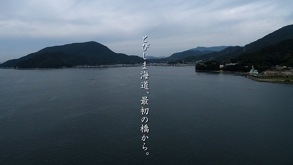
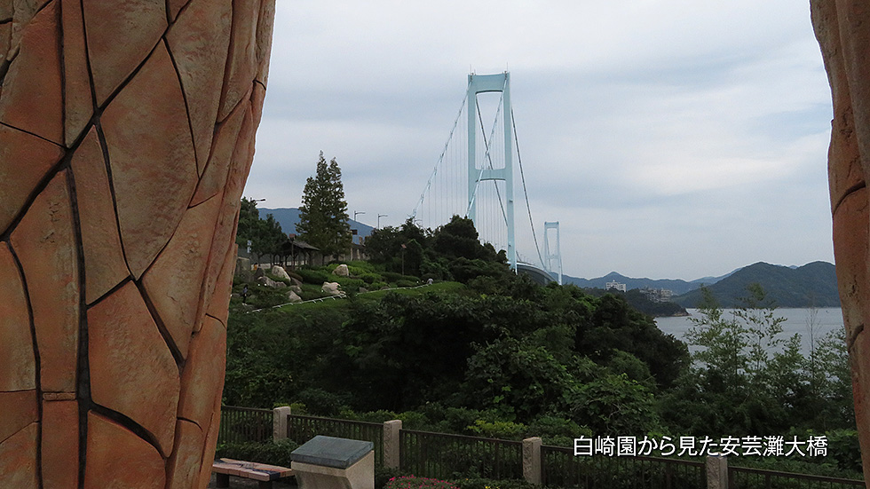
呉から走り始めて、最初に遭遇するとびしま海道で一番大きな橋、安芸灘大橋。渡り始めてすぐの女猫島あたりから西、仁方方面を望む。左手前の低い山を越えれば、広の街。さらにその後の大きな山を越えれば呉の町に至る。画面右には、JR呉線が走っている。最後に、大胆なオブジェのある白崎園から安芸灘大橋を撮った写真もどうぞ。
The Akinada Bridge, the largest bridge on the Tobishima-Kaido, is the first bridge encountered after starting the trip from Kure. The view west from Meneko Island, just after crossing the bridge, toward Nikata. If you cross the low mountain in the left foreground, you will come to the town of Hiro. The large mountain in the distance leads to the town of Kure. The JR Kure Line runs on the right.
Finally, here is a shot of the Akinada Bridge from Shirasakien Park, where there is a bold objet d'art.
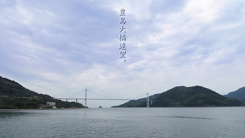
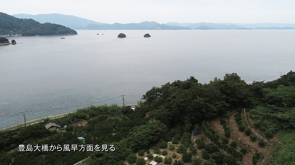
上穂刈島と豊島を結ぶ豊島大橋。とても美しいアーチ橋で、上穂刈島側には、展望台が設えてある。画面右の呉から来ると、トンネルを越えてすぐ目の前に海が飛び込んできて、感動的な気分になる。最後の画面に、この橋の上から北側、風早方面を見た、景色を挟み込んだ。
The Toyoshima Ohashi Bridge connects Kamihokarijima and Toyoshima. It is a very beautiful arch bridge, and there is an observatory on the Kami-Hokari Island side. Coming from Kure on the right side of the screen, the ocean plunges right in front of you after crossing the tunnel, giving you an emotional feeling. The last image is a view from the bridge looking north toward Kazahaya.
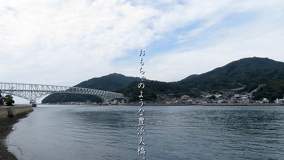
大崎下島の架橋公園あたりから、豊浜大橋を振り返る。橋の右下には、豊島の整備された港がありあり、島の西側全体が昔から賑わっていたそうだ。浜辺には、綺麗に整備された公園や市の施設もたくさんあり、ここもまだ呉市内だ。
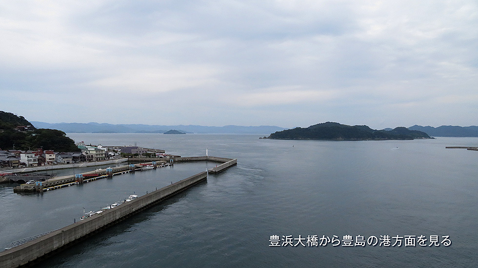
最終画面に、この橋の上からの景色を紹介している。手前に三角島、その先左がはなまる子ども冒険島、右の島は大崎上島だ。
Looking back at the Toyohama Bridge from the bridge park on Osakishimojima Island. To the lower right of the bridge is the well-maintained harbor of Toyoshima, and the entire west side of the island has been busy for a long time. There are many beautifully maintained parks and city facilities along the beach, and this is still Kure City.
The final screen shows the view from this bridge. In the foreground is Misumi Island, beyond it is Hanamaru Children's Adventure Island on the left, and the island on the right is Osakikamijima Island.
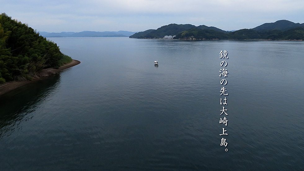
対岸が大崎上島で、MGCターミナルのタンクが見えている。左下は、中ノ島で大崎下島、平羅島、岡村島を繋ぐ役目をしている。遠方に見えているのは、安芸津の街とそれに連なる山々で、その山を越えると東広島市だ。
On the opposite shore is Osakikamijima Island, where the tanks of the MGC terminal are visible. On the lower left is Nakanoshima Island, which serves to connect Osakishimojima, Hirajima, and Okamurajima Island. In the distance is the town of Akitsu and its mountain range, and beyond the mountains is the city of Higashi-Hiroshima.
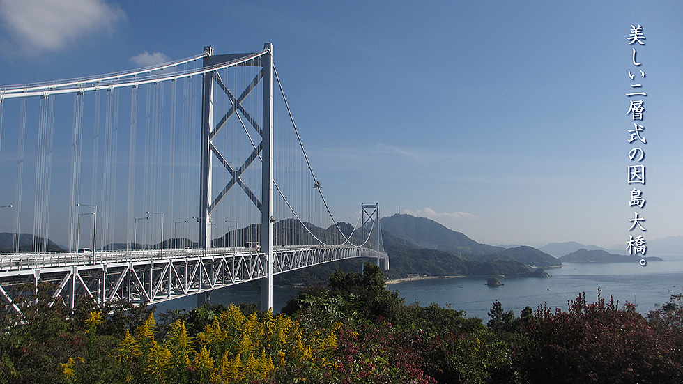
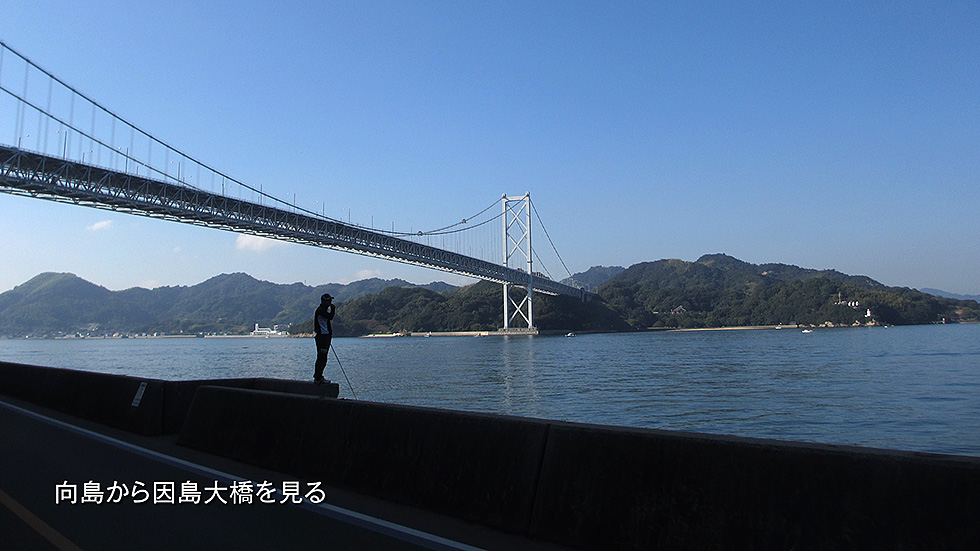
本州から四国への架橋計画が持ち上がってできた、しまなみ海道の人が渡れる最初の橋がこの因島大橋だ。上下二層式になっていて、上が車、下がバイクと自転車、歩行者だ。渡りながら見る景色は、橋構造に多少邪魔されてしまうが、海風を渡る風が直に感じられる絶景だ。写真は、因島側から向島を見たものだが、最後に向島側から見た橋全体の写真も、挟み込んでおく。
The Innoshima Ohashi Bridge is the first bridge on the Shimanami Kaido that can be crossed by people. It is a two-tiered bridge, with cars on the top and motorcycles, bicycles, and pedestrians on the bottom. The view while crossing is somewhat obstructed by the bridge structure, but it is a spectacular sight where one can feel the sea breeze directly crossing the bridge. The photo is a view of Mukaishima from the Innoshima side, but a photo of the entire bridge from the Mukaishima side is also included at the end.
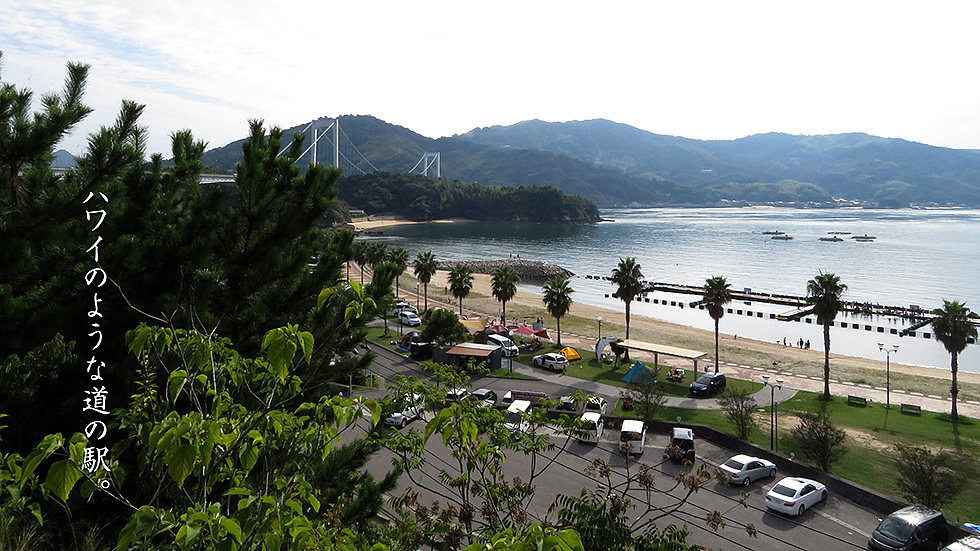
道の駅、伯方S・Cパークは、しまなみ海道の中でも人気の道の駅。佇まいは、上から見るとどこかハワイっぽく、伯方の塩を使ったソフトクリームなどが人気だ。左の橋は、伯方・大島大橋で、ここからの景色も最高だ。左手前の島は、見近島で、しまなみ海道建設時の資材置き場になっていて、現在は無料キャンプ場になっていて、橋から下りることが得きる。橋を渡った先は、大島で、村上水軍の本拠地だ。
最後に橋の上からの景色もはめ込んでおく。正面が大三島、その奥が大崎上島だ。
Hakata S.C. Park, a roadside station, is one of the most popular roadside stations on the Shimanami Kaido. It looks somewhat like Hawaii when seen from above, and its soft-serve ice cream made with Hakata salt is very popular. The bridge on the left is the Hakata-Oshima Bridge, from which the view is also excellent. The island in the foreground on the left is Michika Island, which was used as a materials yard during the construction of Shimanami Kaido, and is now a free campground from which visitors can descend. Across the bridge is Oshima, home of the Murakami Suigun (naval force).
Finally, the view from the bridge is also included. In front is Omishima and behind it is Osakikamijima island.

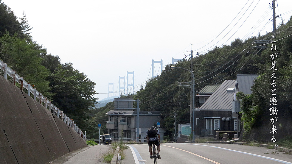
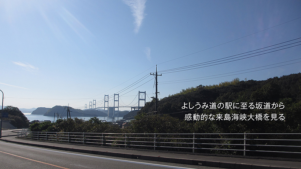
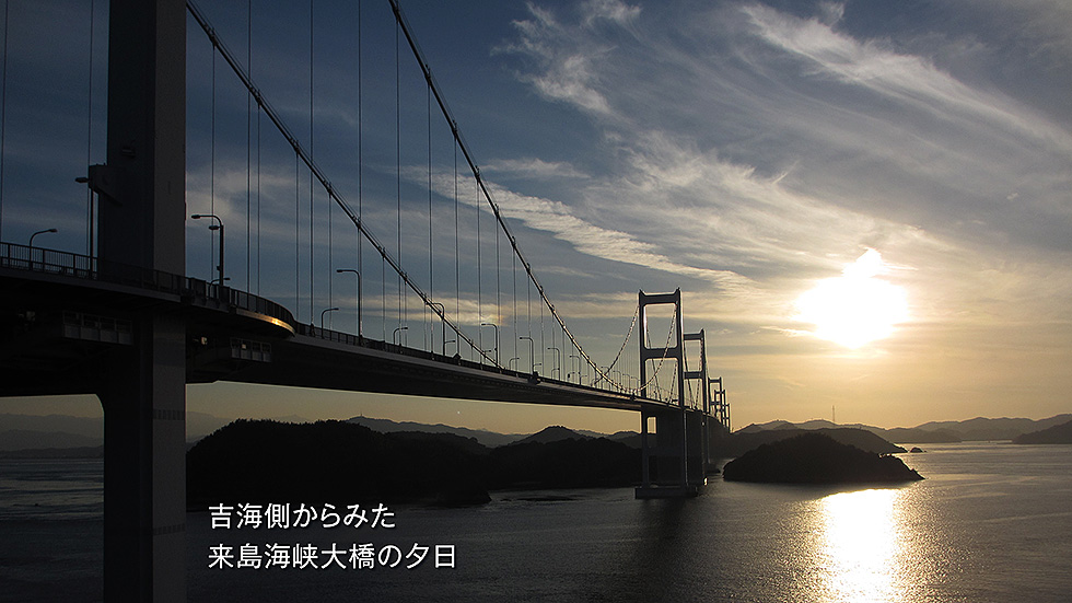
しまなみ海道で、一番高低差のあリ、とてもきつい宮窪峠を越え、吉海の町を越えるとまた上りになり、またかという気分になる。しかし、そこを登り切った大島南ICを越えると、お目当ての来島海峡大橋が目の前に見えてくる。この坂を下ったところが「よしうみ道の駅」で、来島海峡大橋の真下に出る。
最後にもう少し下った、やったーと叫ぶ場所の写真をはめ込んでおく。
After crossing the Miyakubo Pass, which is the highest and most difficult pass on the Shimanami Kaido, and passing through the town of Yoshiumi, the road climbs up again, and I feel like I am going to be back again. However, after crossing the Oshima-Minami Interchange, the Kurushima Kaikyo Bridge comes into view. At the bottom of the hill is "Yoshiumi Roadside Station," right under the Kurushima Kaikyo Bridge.
Finally, I'll insert a photo of the place a little further down the hill where we shouted "Yay!
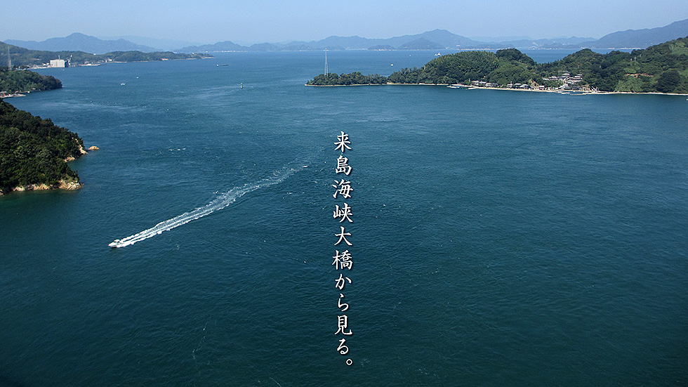
しまなみ海道の一番の見せ場、来島海峡大橋の上から津島、大三島、大崎上島を見た景色。圧巻の景色の中、感動に素直な海外からの観光客は、歓声を上げながら、レンタサイクルで走っていく。瀬戸内海の、約90m上空を約4キロほど、飛んでいく感覚になるので、あたりまえか。瀬戸内海を東西に航行する大型輸送船などは、ほとんどがこの下を通る。
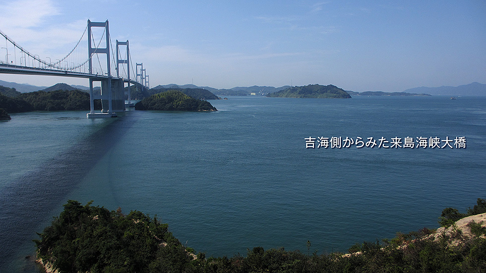
最後に大島側から見た橋の全体も紹介する。ついでにその綺麗な夕景も。
A view of Tsushima, Omishima, and Osakikamijima from the top of the Kurushima Kaikyo Bridge, the best part of the Shimanami Kaido. The tourists from overseas, who were moved by the breathtaking view, were cheering as they rode along on their rented bicycles. It was a natural feeling to fly about 4 km above the Seto Inland Sea, about 90 meters above the sea level. Most of the large transport ships sailing east to west in the Seto Inland Sea pass under the bridge.
Finally, the entire bridge as seen from the Oshima side is also shown. And also the beautiful evening view of the bridge.
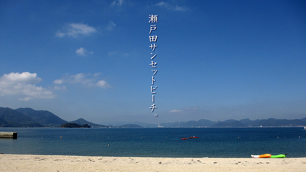
生口島の西側にあるサンセットビーチはその名の通り、美しい夕日が沈む。左が大三島、その先にうさぎ島で有名な大久野島をへて、竹原と三原の町、中国山地まで見渡せる。この近所のサイクリングロード脇には、海の中に洒落た現代アートが飾ってある。最後にそのアート越しに見た景色も紹介する。
Sunset Beach on the west side of Ikuchi Island is, as its name suggests, a beautiful sunset beach. On the left is Omishima, beyond which is Okunojima, famous for Rabbit Island, and the towns of Takehara and Mihara, as well as the Chugoku Mountains, can be seen. On the side of the bike path in this neighborhood, there is a stylish modern artwork in the sea. The last part of this article introduces the view seen through the artwork.

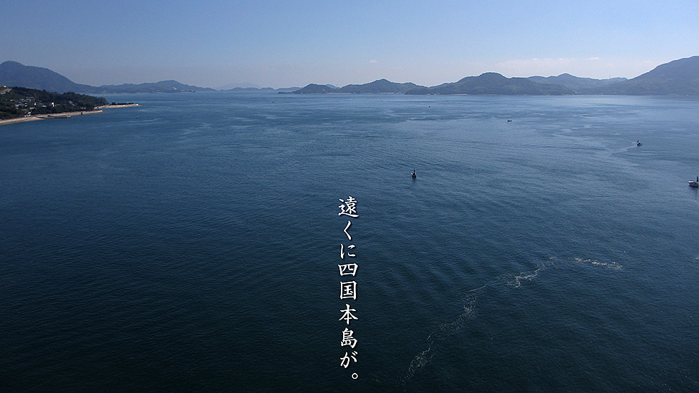
大三島と生口島を結ぶ多々羅大橋の上から東を見た景色だ。左が生口島でその後が岩城島。右側から出てきているのが伯方島で、連なった島々の一番奥は、もう四国本島、四国中央市あたりになる。
最後に大三島の道の駅多々羅から生口島方面を見た、橋の全体写真をはめ込んでおく。
This is a view looking east from the Tatara Bridge connecting Omishima and Ikuchijima. Ikuchijima is on the left, followed by Iwakijima. The island on the right is Hakatajima, and the far end of the chain of islands is Shikoku Island, which is around Shikokuchuo City.
Lastly, I have included a photo of the bridge as seen from Tatara Roadside Station on Omishima in the direction of Ikuchijima.