お気に入りのオリジナル写真を加工して作る、高画質のアハ体験ムービー。フェーズ33は、23年5月に再度訪れた広島の呉から今治までの「とびしま海道」を旅した時の写真だ。
A high quality AHA experience movie made by processing your favorite original photos. Phase 33 is a photo from a trip along the "Tobishima Kaido" from Kure to Imabari in Hiroshima, which I visited again in May 2023.
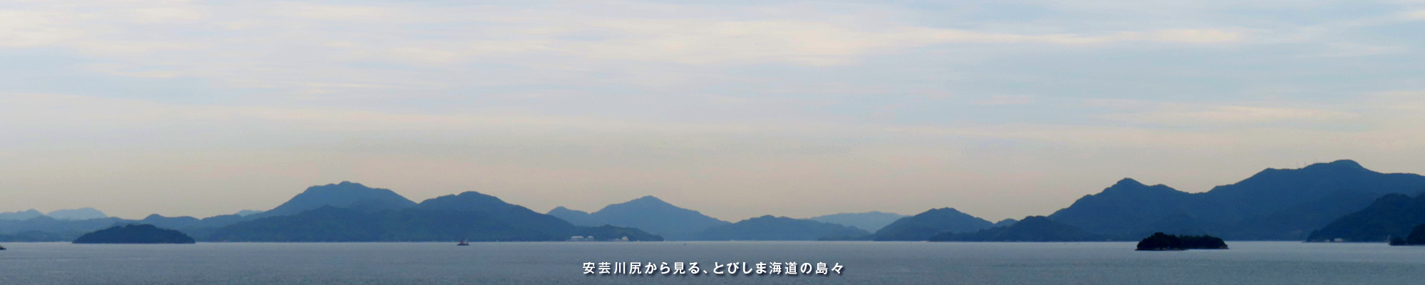
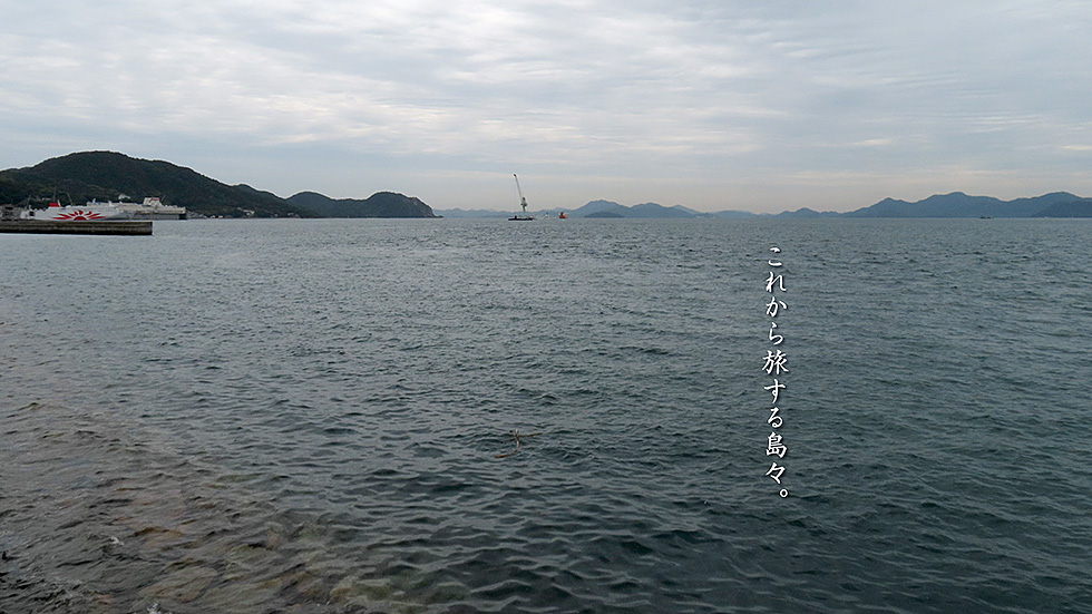
今回は呉線にもう少し乗ってみたくて、呉から川尻駅までJRの別名、「瀬戸内さざ波線」にのってみた。駅に下りて少し走ると、すぐに海岸線に出られる。そこからはこれから旅する「とびしま海道」の島々が一望できる。右から、上蒲刈島、豊島、大崎下島、見えないぐらいの岡村島を挟んで、今回も行くことができない、大崎上島が正面だ。川尻町の東側には、瀬戸内を航行する派手なフェリー、サンフラワーがドック入りしていた。
最後に、川尻の港から見たすぐ南の柏島の姿を載せておく。瀬戸内海は、こんなかわいい小島の宝庫だ。この後ろ側の島は、左が上蒲刈島、右にわずかに見えるのが下蒲刈島だ。
This time, I wanted to ride the Kure Line some more, so I took the JR line, also known as the "Setouchi Sazanami Line," from Kure to Kawajiri Station. After getting off at the station, a short ride brings you to the coastline. From there, you can see the islands of the "Tobishima Kaido" from which you will be traveling. From the right, Kamikamagari Island, Toyoshima, Osakishimojima Island, and the almost invisible Okamura Island are in front of Osakigamijima, which we will not be able to visit again. On the east side of the town of Kawajiri, the Sunflower, a fancy ferry that sails the Seto Inland Sea, was docked.
Finally, I'll include a view of Kashiwa Island just to the south, as seen from Kawajiri's harbor. The Seto Inland Sea is a treasure trove of cute little islands like this one. The island behind this one is Kami-Kamagarijima on the left and Shimo-Kamigari-jima slightly to the right.
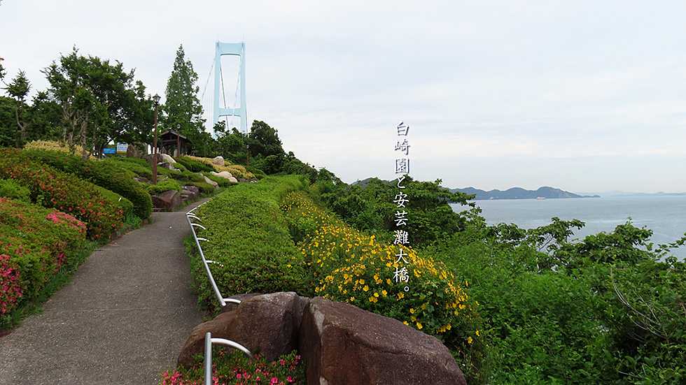
「とびしま海道」の玄関口となる橋長1,175mの吊り橋「安芸灘大橋」を渡ると2本の巨大なモニュメントのある「白崎園」がある。振り返ると安芸灘大橋と女猫の瀨戸、そのさきに川尻方面から竹原あたりまで一望できる。
この公園の目玉は、下蒲刈島の特産品である柑橘の原木の灰を釉薬に使用し焼成してつくった2本のモニュメント。タイトルは「生」,土・火・知・空・水を表しているとのこと。参考までに前回使用した、オブジェ越しの安芸灘大橋もご覧あれ。さらに、蒲刈港からみた安芸灘大橋の全景もどうぞ。
Crossing the 1,175-meter-long Akinada Ohashi Suspension Bridge, which serves as the entrance to the Tobishima Kaido "Shirasakien" with two huge monuments is located. Looking back, you can see the Aki Nada Bridge, Meneko no seto, and beyond that, a panoramic view from Kawajiri to Takehara.
The centerpiece of the park are two monuments made by firing ashes of citrus trees, a specialty of Shimokamagari Island, as a glaze. The title of the monuments is "Sei," which represents earth, fire, knowledge, air, and water. For your reference, please also see the Aki Nada Bridge through the objects used in the previous exhibition. Also, please take a look at the panoramic view of the Akinada Bridge from Kamagari Port.
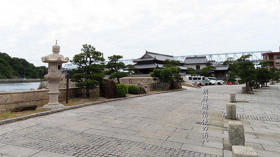
下蒲刈島は朝鮮通信使の街で、関連の施設や資料館などもあって、一種独特な雰囲気のある街だ。朝鮮通信使は、朝鮮王国が江戸幕府に派遣した外交使節で、先進の朝鮮半島や大陸の文化を日本に伝えるという役割も果たしていた。総勢は300名~500名ほどで、この下蒲刈島のもてなしは、「安芸蒲刈御馳走一番」と呼ばれるほど、豪華なもので、朝鮮通信使が2年続けて来日したら広島藩(浅野藩)の財政が破綻するとも言われていた。さらに西国大名や地域の有力者たちも、通信使に会うために宿泊先に駆けつけ、下蒲刈島は、大いに賑わった。
今は、その下蒲刈島と上蒲刈島を跨ぐ橋ができていて、かつての街の借景になっている。
Shimo-Kamagari-jima is the town of the Korean envoys to Japan, and has a unique atmosphere with related facilities and archives. The Korean envoys were diplomatic missions dispatched to the Edo Shogunate by the Kingdom of Korea, and they played a role in introducing the advanced culture of the Korean Peninsula and the continent to Japan. The total number of participants ranged from 300 to 500, and the hospitality offered on Shimo-Kamagari Island was so lavish that it was called "Aki Kamagari Gochiso Ichiban," or "the best feast in Aki Kamagari." It was said that if the Korean envoys visited Japan two years in a row, the finances of the Hiroshima domain (Asano domain) would go bankrupt. Furthermore, the feudal lords of the western part of Japan and other influential people in the region rushed to the island to meet the Korean envoys, and Shimo-Kamagarijima Island was very crowded with people.
Today, a bridge has been built across Shimo-Kamagarijima and Kami-Kamagarijima, which serves as a borrowed view of the former city.
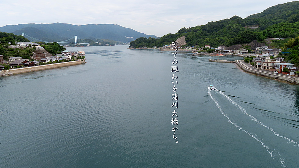
朝鮮通信使が訪れた頃は、たいそう賑わったであろう海の道を蒲刈大橋から見てみた。左の街が朝鮮通信使たちが、ご馳走でもてなされた本陣があった下蒲刈島。その向こうに安芸灘大橋と、中国山地が見えている。右側の街は上蒲刈島で、海岸沿いに豊島を目指すこともできる。
From the Kamagari Ohashi Bridge, we can see the sea road that must have been very busy when the Korean envoys visited. The town on the left is Shimo-Kamagari Island, where the Korean envoys were treated to a feast. Beyond it, the Akinada Bridge and the Chugoku Mountains can be seen. The town on the right is Kami-Kamagarijima Island, and you can also go along the coast to Toyoshima.
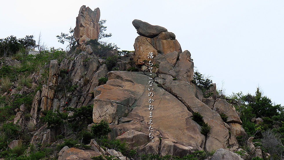
瀬戸内を自転車で走っていると、それは突然目の前に怪獣のように現れる。ここは上蒲刈島の南側にある自然の岩山なのだが、大丈夫か、落ちてこないかと心配になってしまう。上蒲刈島には、いくつかの採石場もある。瀬戸内海全体がプレートにおされ、できてしまった山と溝で、残された岩山が無数の島々を形作った、というのがよく分かる。海だけではなく、こんな岩山も楽しめるのが、この「とびしま海道」や「しまなみ海道」のいいところだ。
Riding a bicycle in the Seto Inland Sea, it suddenly appears before your eyes like a monster. This is a natural rocky hill on the south side of Kami-Kamagarijima Island, and you wonder if it is safe or if it will fall down. There are also several quarries on Kamagamari Island. It is easy to understand that the entire Seto Inland Sea was submerged by the plate, and the mountains and trenches that were created by the plate formed countless islands from the remaining rocky mountains. The beauty of the Tobishima and Shimanami Kaido is that you can enjoy not only the sea, but also these rocky mountains.
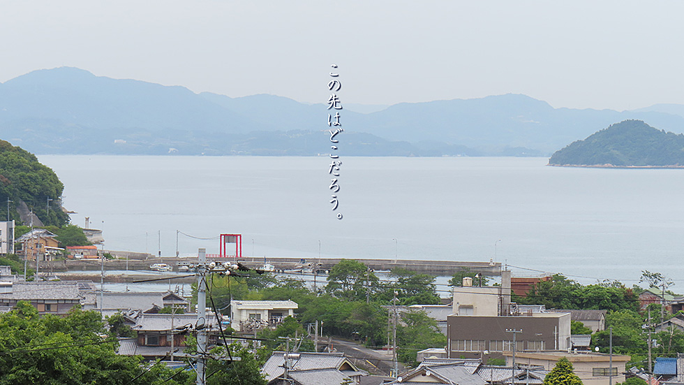
天気のあまりよくない日に行っても、ずっと遠くまで見える。上蒲刈島の中腹から豊島大橋に向かう途中の山道だ。手前が上蒲刈島大浦地区の集落で、左側がおそらく安芸津、右の島はとなりの豊島、ずっと先右側は大崎上島を経てもう竹原だ。
Even on a day when the weather is not so good, you can see much farther. This is a mountain road on the way to the Teshima Bridge from the middle of Kami-Kamagarijima Island. In the foreground is a village in the Oura district of Kamagari Island, probably Akitsu on the left, Toyoshima on the right, and Takehara via Osakikamijima on the far right.
水面まで約50m、ここからの景色はなかなか圧巻だ。手前の沖の島、左は上蒲刈島の三崎と大浦の先、その奥は、安浦、もっと先の中国山地は、東広島になる。
この橋は、塔の高さが100mを越え、最新技術を集めて美しい橋を目指したそうで、平成20年に完成した。広島の県鳥である「アビ」にちなみ、アビ大橋と呼ばれている。
About 50 meters above the water, the view from here is quite breathtaking. In the foreground is the island of Oki, to the left is Misaki and the tip of Oura on Kamagari Island, behind that is Yasura, and further on the Chugoku Mountains is Higashi-Hiroshima.
This bridge, with its towers over 100 meters high, was completed in 2008 with the latest technology gathered to create a beautiful bridge. It is called the Abi-ohashi Bridge after the abi, the prefectural bird of Hiroshima.
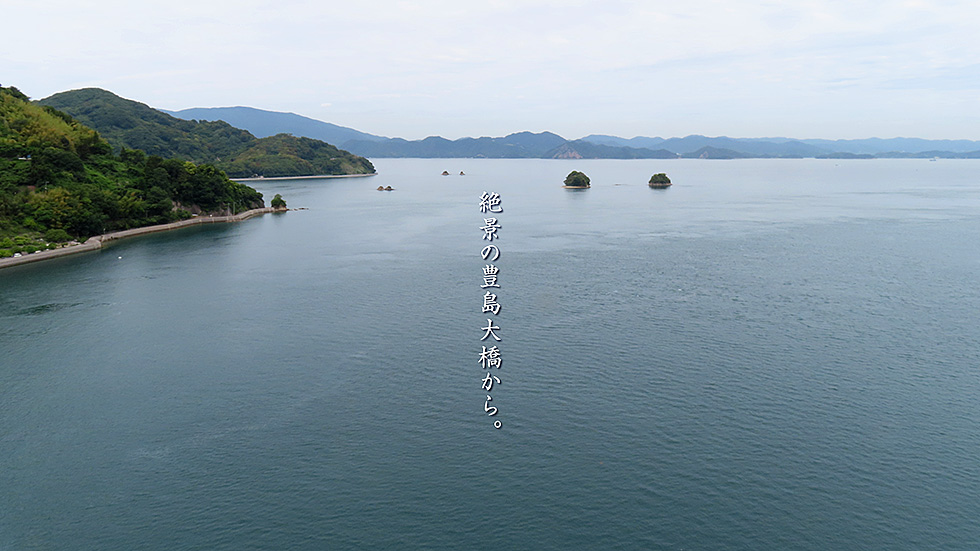
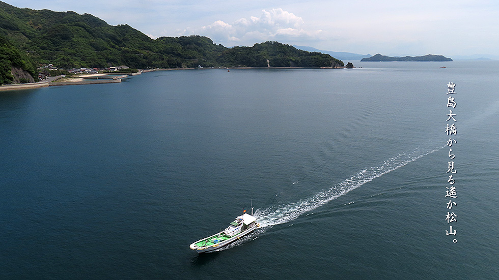
豊島大橋はまた南側も絶景だ。左、豊島の島影の右側に見えるのが尾久比島で、まるで瓢箪のようだ。その先、遠くに見えているのが四国山地で、たくさんの航路を経て、松山に至る。
全く見えてはいないが、鉄腕ダッシュで有名な、ダッシュ島、正式名である由利島もこの方向にある。
The south side of the Toyoshima Bridge also offers a spectacular view. On the left, to the right of Toyoshima's shadow is Okubishima, which looks like a gourd. Ahead, in the distance, are the Shikoku Mountains, which pass through many shipping lanes before reaching Matsuyama.
Although not entirely visible, Dash Island (formally known as Yuri Island), made famous by the popular TV show "Tetsuwan Dash," is also in this direction.
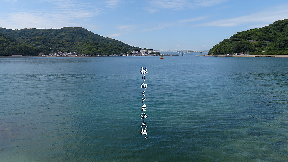
豊浜大橋を渡ると大崎下島で、普通は北側の道を行くのだが、今回はあえて、南側の道を走ってみた。これは大浜港を過ぎたあたりの景色だ。全景が見える豊島大橋のたもとに広がる、静かな街は内浦と豊島の集落だ。その豊島の集落で見つけた「しまcafeきたたに」でお昼のカレーを頂いた。これが美味しくて美味しくて。今まで気づかなかったのが悔しい。
最後に豊島の街の全景と橋の全景もごらんあれ。
After crossing the Toyohama Bridge, you will come to Osakishimojima Island. Normally, you would take the northern road, but this time I ventured to take the southern road. This is the view past Ohama Port. The quiet town at the foot of the Toyohama Bridge, from which the entire view can be seen, is the village of Uchinoura and Toyohama. In the village of Toyohama, I found "Shima Cafe Kitatani" and had curry for lunch. It was delicious. I regret that I had not noticed it before.
Finally, please take a look at the panoramic view of the town of Toyohama and the bridge.
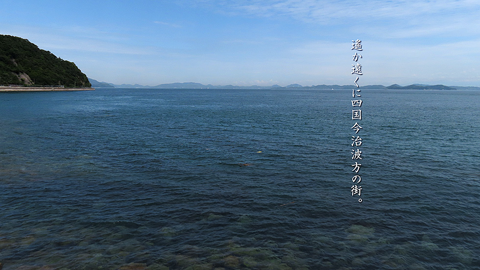
大崎下島の南側道路には、沖友の集落以外あまり民家もなく、ただ道路だけが整備されている。海を見るとはるか先に四国が見えている。航路が集中しているのだろうか、たくさんの大型船が幾度となくすれ違っていく。ここからもう少し東に行くと、波方の岬の先から、来島海峡大橋が顔を見せ始める。
最後に波方から菊間あたりまでのパノラマムービーをちょっとだけ、楽しめるように入れ込んで見た。
There are not many houses on the southern road of Osakishimojima Island, except for the village of Okitomo, and only the road is maintained. Looking out to sea, Shikoku can be seen far ahead. Many large vessels pass by each other, probably due to the concentration of shipping routes. A little further east from here, the Kurushima Kaikyo Bridge begins to appear from the tip of the Namikata cape.
Finally, I included a panoramic movie of the area from Namikata to Kikuma for your enjoyment.